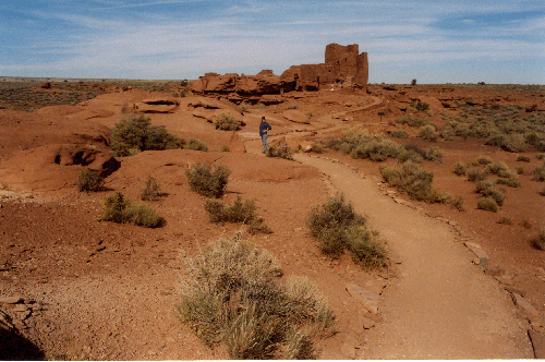
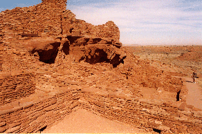
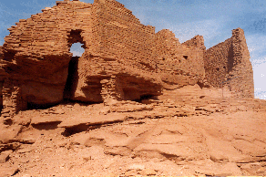
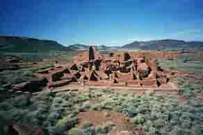
On Thursday (10/25) we set off for our final leg, to Wupatki and Grand Canyon South Rim. The weather was fine and mild, sunny and in the 60's and '70's. Wupatki is a ruin complex to the north of Flagstaff, only several miles north of the town. There are several fine sites here, several of them multi-storied.
 |
 |
 |
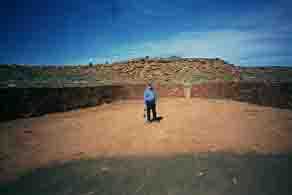 |
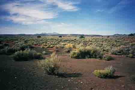
The main site, the Wupatki ruin, features a ball court, a large sunken oval with narrow entrances to at both long ends, walled to about four and half feet in height. This feature clearly was clearly an adaption of the ball courts in the great civilizations to the south, now in modern Mexico. -- We took the time to walk around these ruins and take some photos. The setting is very impressive with its backdrop of the San Francisco mountains that grace the local skyline here, mountains that had great significance to the Indians then and now, and long views into the desert to the north and east.
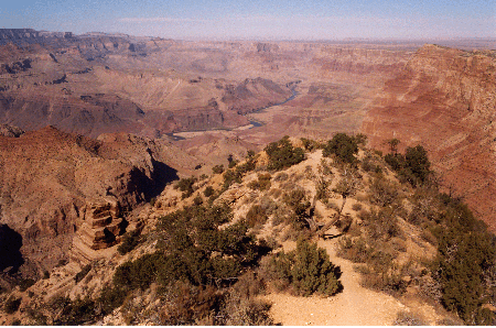
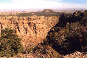
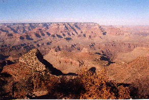
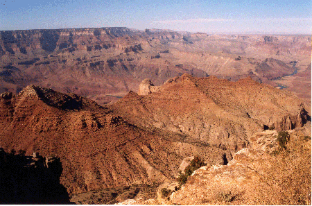
It was early afternoon by the time we reached the Grand Canyon South Rim. The best views we had the whole day were the initial ones at Desert View towards the east. They were the most fun, because it was a vista that we recognized from our stay at the North Rim. We could discern Cape Royal and the end of the Walhalla Mesa, and various 'islands' like the Temple of Vishnu. We enjoyed seeing the Tower built by Mary Cole, an architect of the 'thirties, who selected the face of every stone that was to be visible from the outside.
 |
 |
By afternoon, after lunching at a wayside picnic table, we found a campsite at the Mather Campground, where we pitched our tent, and then trundled off to watch the sunset from Mather Point. Shortly after dark, we packed it in and went to sleep. At least we tried to sleep until some rv owning cracker-ass bozo from Bakersfield started to run his generator at about 9:15 P.M. I popped out of my sleeping bag, got hold of the rules and regs sheet that had been handed to us by the campground ranger, went to confront him, telling him to either turn it off very soon, or that I was going to get a ranger and make him turn it off. It worked. He turned it off, and we went back to sleep. The vagaries of camping!
The next morning, after granola and a hot drink, we went to see the new visitors' center at Mather Point, took a final farewell look at the Grand Canyon, resplendent in the morning sun, and set out for California. We drove south to Williams, where we tanked up, and then set out westward over hill and dale, hills and mountains, forest and desert. We stopped for lunch at the Kingman Deli in Kingman, and made it to Bakersfield by evening, a full and tiring day of dodging semis. On Saturday, we got up late and left by 10 A.M. after breakfast at Carrow's next to the Quality Inn. We made it to Oakland and Tin's Tea House in time for some dim sum, and were home by 4:20 P.M. The only slowdown in two days of driving occurred on the freeway at Todd Road in southern Santa Rosa. We knew then that we were back in Sonoma County.