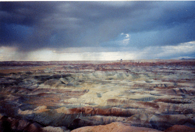

We decided to drive southward for what turned out to be many empty miles, mesas and cinder cones at times in the distance - to Winslow and spend the night. For the only time on the trip it rained on us as we were driving, great, big drops, for about three minutes. Some miles north of Winslow, we stopped at a park, Little Painted Desert State Park, where we took photos of the Chinle cones of different hued sandstone and volcanic ash with dramatic rain clouds in the distance.
Just at dusk, we pulled into Homolovi Ruins State Park. We talked briefly with a ranger at the end of his daily rounds, who told us that the rains wouldn't make it this far, that it would blow over. He was right. We camped that night with a whole bath station house to ourselves, complete with hot water and commodious showers. There were no other tent campers in the park, and only a handful of RVs. Winslow, with its vast train yards, some miles to the south, provided some night time noise, as did the coyotes, but in the main it was a peaceful night. We camped out a total of nine nights, and grew accustomed to the experience. Many routines are voided, everything is reduced to essentials; a quick nighttime meal, sharing a can of soup, a few bites of canned salmon and a cracker, a tomato or a piece of fruit, reading a few minutes after nightfall, falling asleep and getting up shortly after dawn, usually after the crows announce the rise of the sun.
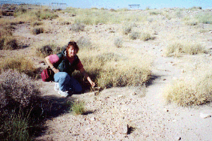
The ranger had told us to make sure to visit the ruins before we left the park, and we were very happy to do so. They turned out to be well worth while. The park is a relatively recent phenomenon, circa the mid- 'eighties. One of the reasons for its creation was that the ruins were often vandalized: people would come and dig on their own, find pots or sherds and sell them. The Hopi agreed that making a park here would help stabilize the situation in terms of the ruins that remained. In modern Hopi, homohl'ovi means 'low' or 'short hills. The site consists of some ruins on small bluffs right on the Little Colorado River, which flows northward out of Arizona's White Mountains to join the Colorado on the eastern side of the Grand Canyon. It is conjectured that cotton was extensively grown here. -- One of the sites, Homolovi II, was partially excavated. The main feature was the ruin of a large kiva. By and large however, Homolovi I, III and IV were not excavated and it was obvious that they would not be in accordance with the wishes of the Hopi leadership.
 |
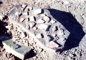 |
Often at the Homolovi sites, as we were walking on the filled in tops of the houses with thousand year old black-and-white, red-and-black, and gray-pinched 'corrugated' pottery shards literally covering the ground, we had the strong sense that our own lives were almost a part of the whirl of those who had lived here long ago. --Taking pottery shards is forbidden, as is making arrangements of them on stones, but obviously, many people had done this. The pottery on tops of flat stones that we saw seemed a form of reverence. On the short, knee-high wall of the large, excavated kiva, someone had placed a small metal crucifix in honor of those who lived there long ago.
We left Homolovi later than intended, and drove eastward to Holbrook, where we had a nice talk across several tables with a local couple. The man was wheelchair bound, the woman, and ex-physical therapist who had worked on both the Navajo and Hopi Reservations. We asked them what time it was, a complex matter in these parts. We were confused. Arizona runs on Mountain Standard time, the Navajo Nation runs on the same time as New Mexico, a form of daylight savings time, but the Hopi, who don't get along with the Navajo, seem to run on the same time as Arizona. Camping further conspired to confuse our clocks, our personal sense of diurnal rhythms. Get up at sunrise, sleep at sunset, seemed to be the tune our bodies now wanted us to dance to. So, we had lunch at 11 A.M. -- The couple, whose names we did not find out, had come out to this part of Arizona eleven years ago. They liked it, and stayed. We got a few more travel tips about our further route of the day and went on to our next objective, Petrified Forest N.C. east of Holbrook.
 |
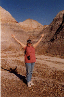 |
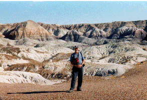
Petrified Forest and the Painted Desert are one entity, the latter being essentially a loop north of Interstate 40. Here, we drove and did some of the trails. The most memorable of them was a mile long descent into a basin of mud cones and little hillocks, the Blue Mesa trail. The hills were formed of volcanic ash that had mixed with pebbles to form a kind of quickly eroding conglomerate. We took lots of pictures in this strange landscape, and stopped to look at the pebbles and stones, some of which were obviously fossilized parts of plants and little marine creatures.
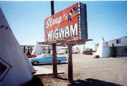 Over and over again, we found ourselves reminded of the classic days of Route 66. Often, it forms the main street of towns like Gallup and Holbrook, Grant, Williams, Kingman. There are countless small motels, most of them pretty seedy dives, that have that thirtie's look to them. Countless more have gone out of business. Sometimes there are just skeletons of buildings left standing, or piles of old wood and rubble. Efforts to preserve Historic 66 are much in evidence, too. Some towns have retro-inspired diners and grills right on Historic 66 and seem to thrive. So more than once, we got our kicks and whatever else we needed at the moment on Route 66.